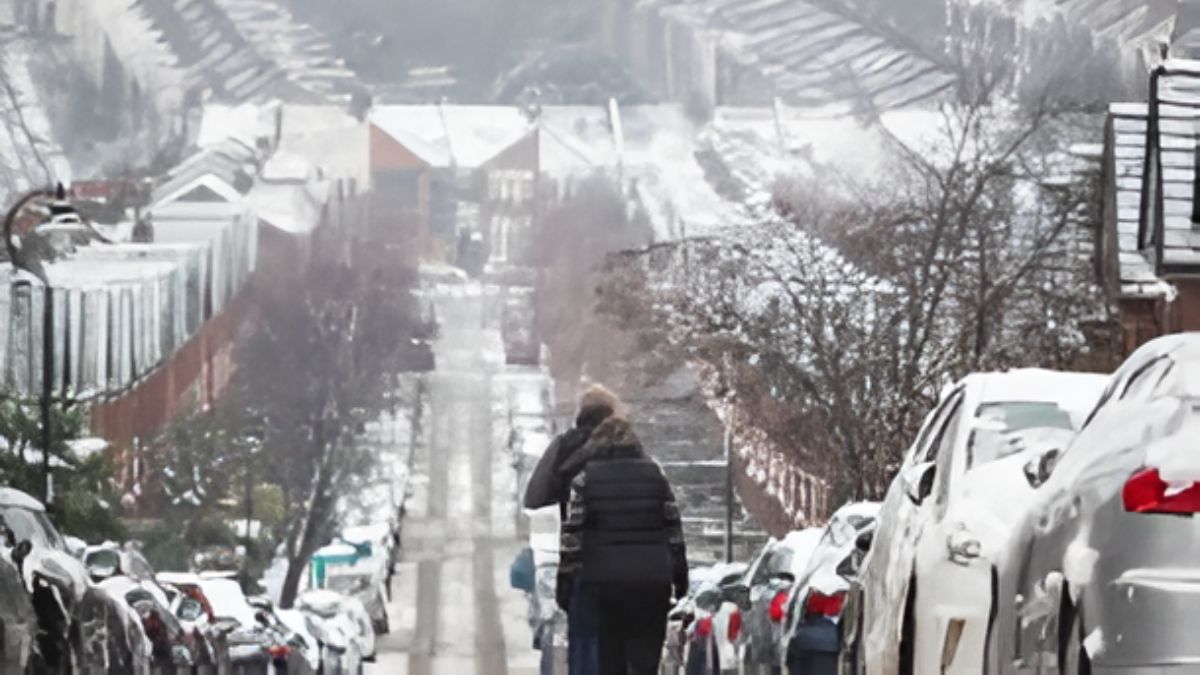
The UK is bracing for a severe and highly unusual weather phenomenon following the chaos caused by Storm Goretti. The national weather agency has issued a stark warning regarding an “extremely hazardous” event expected to batter the country this Sunday. While the country is still reeling from heavy snowfall and strong winds, the Met Office is now predicting the arrival of freezing rain, a rare occurrence in the British Isles. This dangerous weather event is forecast to take place between 2pm and 3pm on Sunday, bringing with it significant risks to travel and infrastructure.


Meteorologists are urging the public to exercise extreme caution as this event unfolds. Unlike standard snow or rain, this specific phenomenon presents unique dangers that many UK residents may be unfamiliar with. The timing of this event is critical, coming just as many parts of the country begin to thaw from the recent blizzards. Residents, particularly in the Midlands, are being advised to prepare for conditions that could make roads and pavements treacherously slippery.
What is Freezing Rain?
For many in the United Kingdom, the term “freezing rain” may be new. However, in other parts of the world, particularly in North America, it is a well-known and feared winter hazard. The Met Office defines this event as occurring when water droplets freeze almost instantly upon contact with the ground. This differs from sleet, which is partially melted snow, or standard rain that freezes overnight into ice.


The process is as follows:
* Precipitation falls as snow through a deep layer of sub-freezing air.
* The snowflake then enters a layer of warm air aloft, causing it to melt into liquid rain.
* The rain then falls back into a shallow layer of freezing air near the ground.
* Because the droplets are “supercooled,” they freeze instantly upon hitting any surface with a temperature at or below freezing.
This results in a coating of clear ice, often referred to as “glaze” or “black ice,” which is notoriously difficult to see and incredibly hazardous to walk or drive on.
Storm Goretti’s Legacy and Continued Warnings
This impending weather event follows the destructive path of Storm Goretti, which brought significant disruption to the UK earlier this week. The storm dumped heavy snowfall across large swathes of the country, causing school closures, flight cancellations, and gridlocked traffic. As the storm system departs, it is leaving behind a volatile atmosphere ripe for these extreme conditions.
The Met Office has maintained a yellow weather warning for snow and ice, which remains in place between 2am and 3pm on Sunday. While much of the initial alert focused on snow accumulation, the updated guidance emphasizes the risk of freezing rain as the day progresses. This transition from snow to freezing rain creates a complex and dangerous situation for emergency services and motorists alike.
Regional Impacts and Snowfall Totals
The forecast indicates a high degree of variability across the UK depending on elevation and the intensity of the precipitation. The Met Office provided specific details on what different regions can expect:
* Northern England: Snow is expected primarily at elevations above 200 meters.
* Scotland: Snow may fall to lower levels in the morning but will likely be restricted to higher ground by the afternoon.
* Accumulation: At lower levels, 2 to 5cm of snow is likely in places, with the potential for temporary accumulations of up to 10cm before it transitions to rain.
* Higher Ground: For areas above 200 meters, 10 to 20cm of snow is possible. In locations exposed to strong southerly winds and the highest parts of Scotland, accumulations could reach up to 30cm.
The strong winds accompanying this system will cause snow to drift, creating deep pockets of snow and reducing visibility. As the band of precipitation pushes eastward through the afternoon, the mix of rain, sleet, and snow will make road conditions incredibly difficult to manage.
The Dangers of Black Ice
One of the most significant concerns regarding freezing rain is the formation of “black ice.” This refers to a thin coating of glaze ice on road surfaces, pavements, and other surfaces that is visually transparent. Because it allows the dark road surface to be seen through it, it is extremely difficult for drivers and pedestrians to detect.
The Met Office has explicitly warned that ice formed from freezing rain is “difficult to see and difficult to clear.” This presents a major hazard for the evening commute and overnight travel. Unlike snow, which provides some traction, black ice offers virtually no grip, leading to a high risk of vehicle skids and pedestrian slips and falls. The glaze effect can also coat trees and power lines, adding a risk of damage to infrastructure similar to ice storms seen in the United States.
Preparing for the Sunday Event
As Sunday approaches, the advice from the Met Office and emergency services is to avoid non-essential travel during the peak of the event. If travel is necessary, drivers should ensure their vehicles are winter-ready with appropriate tires and cleared windows. It is also advisable to carry emergency supplies such as blankets, food, and water, as getting stuck in the freezing conditions could be dangerous.
For homeowners, the risk of ice forming on driveways and steps means taking precautions to salt these areas if possible. The sudden freeze can catch many off guard, turning routine journeys into hazardous undertakings. The combination of the remnants of Storm Goretti and this new freezing rain event creates a perfect storm of hazardous conditions for the UK.
Conclusion
The UK is facing a rare and dangerous weather situation as freezing rain prepares to batter the country this Sunday. Following the chaos of Storm Goretti, this “extremely hazardous” phenomenon poses a severe threat to travel safety and infrastructure across the Midlands and beyond. With the Met Office issuing yellow warnings and predicting significant ice accumulation, the public is urged to remain vigilant. Whether it is the risk of black ice on roads or the potential weight of glaze on trees and power lines, the impact of this event will be felt long after the rain ceases. Staying informed and avoiding unnecessary travel is the best way to stay safe during this rare meteorological event.